Hiking

Easy

Galtbergalm

Hiking tour

9,00 km

03:30 h

661 hm

1792 m

Information

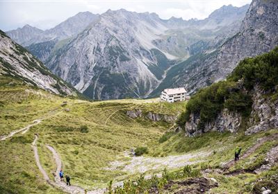
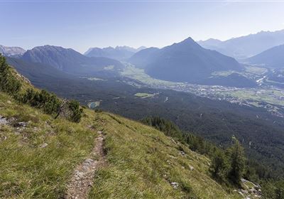
Take the hiking trail directly opposite the petrol station, which leads you into a quiet and natural environment right from the start. After just a few steps, you will leave the noise of the road behind you. The path that now lies ahead of you takes you deep into the valley, where the silence of nature reigns. Follow the path, which initially runs along a forest road. The forest will surround you protectively as you climb leisurely down into the valley. After a while, the path begins to wind its way up the slope in gentle hairpin bends. This section of the hike takes you higher as you move through the picturesque landscape. The effort is rewarded when the path finally leads you to the Galtbergalm. This enchanting alpine pasture is enthroned on a breathtaking hill. From here, you will be captivated by the fascinating view of the valley. Experience the tranquillity of nature, the fresh mountain air and the majestic view as you reach the Galtbergalm. This hike promises not only physical exercise, but also an escape into the beauty of the alpine landscape.

Recommended Equipment

good shoes, enough to drink

Features & Characteristics

Stamina

Start Point

Fernpass

End Point

Fernpass

Map & Elevation Profile

Similar Tour Suggestions

Eagle Walk Stage: 20

Hard

Hiking

Eagle Walk Stage 20: Hanauer Hütte - Württemberger Haus

Eagle walk

11,00 km

07:00 h

1240 hm

930 hm

2480 m

2015-Schwimmen & Tauchen-Starkenberger See-Tarrenz-©Unbekannt (16).jpg

Easy

Hiking

Starkenberger See

Hiking tour

Loop Hike

5,00 km

02:00 h

106 hm

110 hm

900 m

im_huette_anhalter_015.jpg

Medium

Hiking

Anhalter Hütte

Hiking tour

Hut hike

6,00 km

03:00 h

514 hm

515 hm

2195 m

Anhalter Hütte-©Anhalter Hütte (5)-1.jpg

Medium

Hiking

Anhalter Hütte (Plötzig)

Hiking tour

Hut hike

9,50 km

04:00 h

347 hm

890 hm

2198 m

Dorfrunde Imsterau.jpg

Easy

Hiking

Imsterau village walk

Hiking tour

Loop Hike

3,50 km

01:00 h

34 hm

719 m

Oberer Rotanger.jpg

Easy

Hiking

Oberer Rotanger

Hiking tour

2,70 km

01:30 h

220 hm

25 hm

1084 m

imst_tourismus_bergsteigen_wyhlidal_west_0305.jpg

Medium

Hiking

Alpjoch (No. 28)

Hiking tour

8,80 km

05:00 h

320 hm

835 hm

2339 m

WF_Imst_T27_IMG_01_9216_Durner.jpg

Hard

Hiking

Imster Höhenweg

Hiking tour

13,00 km

09:00 h

1782 hm

805 hm

2557 m

tirolimster-bergbahnenAlpine Coaster Logoarea47trustyou