Hiking

Hard

Roter Stein

Hiking tour

8,00 km

1165 hm

2366 m

Information

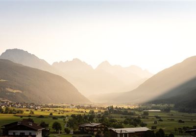
The hike from the Fernpass to Roter Stein is a challenging tour for experienced mountain hikers that requires good fitness, a head for heights and surefootedness. From the start at the Fernpass summit, the path initially climbs slightly into the Kälbertal before becoming narrower and steeper towards the Galtberghütte. We continue via Almboden towards Rotenstein, whereby the path becomes rockier and more alpine with every meter of elevation. The demanding climb is rewarded at the summit with a breathtaking panorama that is worth the effort. This tour is ideal for anyone looking for a serious alpine challenge.


Recommended Equipment

Hinweis: Diese Wanderung ist anspruchsvoll und nur für erfahrene Bergwanderer ohne Höhenangst geeignet. Achte stets auf deine Sicherheit und plane ausreichend Zeit für diese intensive Bergtour ein.

Features & Characteristics

Stamina

Skill

Start Point

Fernpass

End Point

Roter Stein

Map & Elevation Profile

Similar Tour Suggestions

2000px-Muszla_Jakuba.svg.png

Medium

Hiking

Jakobsweg - connection Nassereith - Lermoos

Long distance trails

18,50 km

05:30 h

523 hm

364 hm

1239 m

WF_Imst_T03_IMG_04_2753_Plott.jpg

Easy

Hiking

Geology nature trail Forchet

Thematic route

Hiking tour

3,90 km

02:00 h

77 hm

105 hm

735 m

20240608_132458.jpg

Medium

Hiking

Tschirgant (No. 24)

Hiking

Hiking tour

08:30 h

1162 hm

1592 hm

2332 m

Oberfeldwaal Roppen 1.gpx.jpg

Easy

Hiking

Oberfeld irrigation canal Roppen

Hiking tour

1,90 km

01:15 h

43 hm

760 m

Screenshot 2024-04-26 104202.jpg

Medium

Hiking

Kohlstattsee

Hiking tour

6,50 km

314 hm

362 hm

1500 m

imst_tourismus_rosengartenschlucht_wyhlidal_west_0009.jpg

Easy

Hiking

Rosengartenschlucht

Hiking tour

4,40 km

02:30 h

282 hm

279 hm

1049 m

2018-Wandern-Bergsteigen-Tarrenz-Sinnesbrunn-Alpleskopf-web-©Rudi Wyhlidal (97).jpg

Medium

Hiking

Galflun Alm

Hiking tour

3,80 km

01:13 h

95 hm

1900 m

DSC_0647.JPG

Medium

Hiking

Milsbergsteig

Hiking tour

6,10 km

334 hm

523 hm

1183 m

tirolimster-bergbahnenAlpine Coaster Logoarea47trustyou